

Hart-Montague Bike Trail is a trail running south-north between the towns of Hart and Montague in western Michigan. The trail runs for 22.7 miles through small rural towns, wooded areas, farmland, orchards, and occasionally passing by some industrial sights.
The official name of the trail is: William Field Memorial Hart–Montague Trail State Park. The park consists of the trail and the immediate surrounding area. It has the name of its creator.
William Field was a fruit grower in the town of Shelby. In 1982 he bought the corridor of dismantled railroad, turned it into a recreational trail, and donated it to the state. In 1989, the northern half was opened, and it became the state’s first paved rail trail. The second half was completed in 1991.
In 2016, the trail was completely re-surfaced and widened to 10 feet.
HART-MONTAGUE BIKE TRAIL
The trail passes through a few towns. I rode the trail from Hart through Mears, Shelby, New Era, and Rothbury to Montague.
HART
From US-31 I got on Polk Rd going east and drove for about a mile when I noticed a trail crossing the road and a big parking lot on the left (north) side of the road before you get to the Hansen Foods store. I parked my car there. However the trail began somewhere further north because it does not start in the parking lot, but, besides going south-west, it also goes north-east.
So, I decided to check first, where it begins, and I rode towards downtown Hart. After riding for about half a mile, I got to the beginning of the trail. It starts at the intersection of two residential streets – N Water St and Wood St. (43.696572, -86.366354) There is nothing there. No parking lot. No big sign. The trail just begins.

So, I took a few pictures, turned around, and began riding south.
The trail is smooth. As mentioned previously, it was re-paved in 2016. The parking lot at Polk Rd is considered the Hart Trailhead. It has a lot of room, restrooms, and a big map of trail routing through Hart.

(The map shows the routing through Hart to John Gurney Park, where you can camp.)

As you leave Hart, you enter the wooded part of the trail with a lot of shade. However, if you check the satellite image on Google Maps, you will notice that the trees do not extend much away from the trail.

MEARS
The trail continues like this most of the way to Mears, which is 2.5 miles away. The trail does not enter the town but skirts it on the southeast side.
From time to time it crosses some roads – most of them not very busy.
When you pass Mears, you begin riding directly south and later southeast towards the next town – Shelby, through some open areas without any shade.

SHELBY
While you ride only a block away from downtown Shelby, the trail runs mostly through some industrial areas of town. Shelby is 5.3 miles south of Mears.
There is also Shelby Trailhead north of W 3rd St.
When you leave Shelby, the trails go through some farm lands.

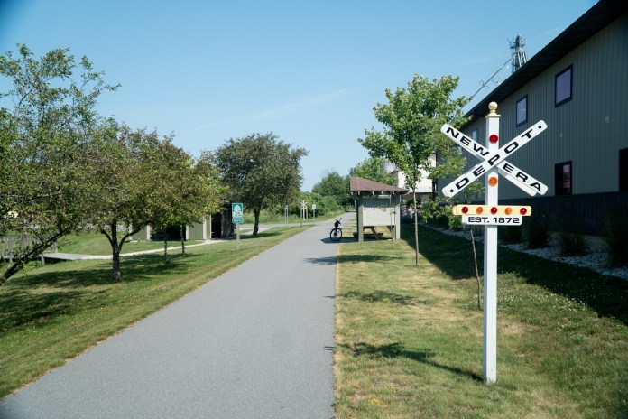
NEW ERA
About 2.5 miles south of Shelby, still before entering the town of New Era, you pass on your left well visible, big farm store called Country Dairy Farm Store. A good and close place to stop to eat, or just to get some ice cream.
From there it is about a mile further south to New Era.
Here, again, even though you are only a block from the main street, the trail passes by some industrial sights.
Just when you are on the northern side of town, you pass by the trail shelter with restrooms and some trail-related information.
ROTHBURY
Riding further south towards Rothbury, you pass to some sparsely wooded areas with very little shade. Rothbury is almost 4 miles south of New Era.
Again, as in other towns, the trail passes through some industrial areas of town.
There is another trailhead here. It is located just south of the industrial area that is south of W Winston Rd. The trailhead parking is at the corner of Community St and S Michigan Ave. It is about 500 ft away from the trail, and I do not remember any sign there informing you about it, or pointing towards it. So, you need to look for it, if you want to stop there.

MONTAGUE
From Rothbury, the trail goes south through some sparsely wooded areas, not providing any shade. It takes about 6 miles to get to the outskirts of Montague. The trail used to end at Stanton Blvd. However, it was extended further south and now it officially ends in the Whitehall Rail Trail parking Lot north of Covel Park and just south of the White River Bridge.

TRAILHEADS
The trail has five official trailheads, mentioned in the trail description above. There is also, what’s called a “staging area” in New Era. I assume it is the pavilion there.
To see what facilities are available at each trailhead, reference the map.
Below are the GPS coordinates for each trailhead.
- Hart (43.6890388,-86.3746556)
- Shelby (43.6114759,-86.3669726)
- New Era (43.559670,-86.344604)
- Rothbury (43.5037622,-86.3473928)
- Montague (43.4174509,-86.3536603)
- Whitehall (43.4132833,-86.3516663)
CONNECTED TRAILS
Right before the Trailway Campground, at the Montague Trailhead, the Hart-Montague Trail connects with the Medbery Bike Trail – about a mile and half long trail going through Montague.

At the Whitehall Trailhead it connects with Fred Meijer Berry Junctions Trail – 11.5 mile long trail that connects to Muskegon Lakeshore Trail, allowing you to ride further south to Muskegon, and on some further connected trails to Grand Rapids or Holland.

CAMPING OPTIONS
From what I was able to find, the Hart-Montague Bike Trail offers two camping options – one at each end:
Hart – John Gurney Park
Montague – Trailway Campground

MY RATINGS
Scenery (0-boring, 10-breathtaking): 3.5 (about 40% of the time, the trail goes through wooded areas, the rest – through some small rural towns, farmland, orchards, and seldom through some small industrial sights)
Easy-to-Follow (0-no maps, often broken into sections without clear directions, 10-well marked with maps showing current location): 4.0 (once on the trail – easy to follow, but no printed maps available (maybe because of the COVID situation), some trailheads not that easy to find, ends not marked at all, when connecting to other trails in Montague)
Food Access (0-no food facilities at all, 10-food available every few miles): 5.0 (definitely in Hart and Montague, also, in a few small towns along the trail. The only exception located right off the trail is the Country Dairy Farm Store.)
Restrooms (0-none, 10-modern restrooms every few miles): 7.0 (restrooms in some parks, gas stations, etc. along the trail, not always by the trail, and at all trailheads)
Surface Quality: 10.0 (newly paved, 10 ft wide)
Accessibility (0-no trailhead parking lots, no easy access, 10-trailhead parking, and many in-between): 9.0 (big parking lots at trailheads, or close, also many smaller parking lots along)
Usage (0-not used at all, 10-extremely popular): 6.0 (not very popular during the week, fairly popular on weekend)
Hills (0-completely flat, 10-Extremely hilly): 1.0 (pretty much flat)
Sun/Shade (0-no shade at all, 10-completely shaded): 4.0 (about 40% shaded, mostly just south of Hart)
FINAL THOUGHTS
Hart-Montague Bike Trail is a nice path to go for a relaxing ride. The trail is paved and smooth. The road intersections are not busy, allowing for quick crossings. There are plenty of picnic tables along to stop and relax when you get tired.
While there are practically no places to stop to eat or drink by the trail, the towns are spaced only a few miles apart, providing such places within a very short distance off the trail.
If you are looking for scenery though, go somewhere else. You won’t find it on this trail.
RESOURCES
https://www.getoffthecouch.info/oceana/railtrail.htm
https://cityofmontague.org/parks-amenities/bike-trail/
https://cityofmontague.org/wp-content/uploads/2017/01/bike_trail_map.pdf
https://en.wikipedia.org/wiki/Hart%E2%80%93Montague_Trail_State_Park
https://cityofmontague.org/trailway-campground/
https://mitrails.org/william-field-memorial-hart-montague-trail.php

* * *
If you are interested in other bike trails in southwestern Michigan, you might want to read my post about the Kal-Haven Trail.