

The Kal-Haven Trail is a rail-trail going east-west between the cities of Kalamazoo and South Haven. The trail is 33.5 miles (55 km) long. It is dirt trail sparsely covered with crushed limestone. It is fairly smooth with up and down gradual undulations. The only short steep section is already in the town of South Haven. There are occasional rougher short sections. The middle section of the trail has some two-track stretches. Occasional chipmunk holes in the trail will rattle your bike. There are few sandy local spots.

The trail mostly goes through the woods.
It has many parking spots along with outhouses, picnic tables and water pumps.


The trail is very popular on weekend, but not during the week. You will find most people on the trail close to South Haven.
Trail is well marked, and there are posted maps as well as printed maps available. I checked few boxes and even though it was in the middle of the summer, they were full of maps. So, it means that they are regularly checked and stuffed.

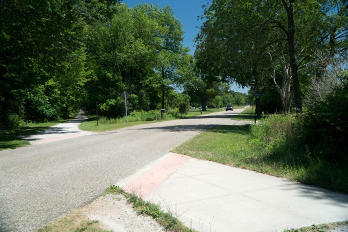
The trail crosses many driveways and roads. The vegetation on both sides comes all the way to the road’s edge blocking the views. So, be really careful when crossing. Most of these roads have high speed limit – 45, 50 or 55 mph. Therefore, the drivers will not be able to react to a cyclist crossing in front of them. So, slow down or stop completely and check that the road is clear of approaching vehicles before you cross.
Two miles from South Haven the trail goes over a covered bridge. This is what you often see in pictures.

In South Haven the trail goes close to Black River, and the section that takes you to downtown follows not far from it.

It is definitely a great trail to get a nice relaxed ride. I would recommend it, especially if you are in the area.
Kalamazoo Trailhead
The Kalamazoo trailhead is located few miles north-west out of town. You can get to it by riding from downtown on the Kalamazoo River Valley Trail. The trailhead is easily recognized by the red caboose by the trail. It has a pavilion. The parking lot is pretty big.


South Haven Trailhead
The South Haven trailhead is very similar, but no caboose. The parking lot there is also pretty big.


Bloomingdale Mid-Point Station
The trail every few miles passes through many small towns. The one in the middle – Bloomingdale has a what’s called Mid-Point Station, by the Train Depot museum there. There is a dedicated fenced parking lot for trail users, and also a unmarked parking off the road in front of the trail by museum, and also a parking lot in front of the store, that is often used by cyclists arriving there by car.

Camping Options
There used to be two primitive campgrounds along the trail. One – near Gobles – The Goddess Grove. The other one – near South Haven – The Eagle Point. Since 2017, they are no longer maintained. However, I found out that people still use them, and the image below is the proof.

Fortunately, there are few private campgrounds along or close to the trail that still provide some camping options. The first one is about 5 mile east of South Haven, right by the trail at 66th St. It is Kal-Haven Outpost.
Next one is South Haven Family Campground south of the trail on 64th St.
Then in Bloomingdale there is the Shady Brook Park campground. The stay there is free.
Then in Kalamazoo area, not by the Kal-Haven Trail, but by the north spur of Kalamazoo River Valley Trail in Parchment, there are Markin Glen Campgrounds. The facility is run by the city.
Those are your options if you are touring, and want to camp.
Additionally, there is Van Buren Trail going from South Haven to Van Buren State Park (only 3.5 miles). The state park has a modern campground. This is another option when camping while touring.
The trail goes further south for a total of 14 miles.

My Ratings
Scenery (0-boring, 10-breathtaking): 6.0 (about 90% of the time, the trail goes through wooded areas, occasionally, through by some farm land)
Easy-to-Follow (0-no maps, often broken into section without clear directions, 10-well marked with maps showing current location):
10.0 (very well marked, also posted maps in many areas, as well as printed maps in boxes along the trail)
Food Access (0-no food facilities at all, 10-food available every few miles): 4.0 (definitely in South Haven, otherwise, in few small towns along the trail)
Restrooms (0-none, 10-moderen restrooms every few miles): 8.0 (outhouses every few miles along the trail, and at trailheads)
Surface Quality: 7.0 (dirt/limestone surface, sometimes two-track, occasional bump due to chipmunk hole, few localized sandy areas)
Accessibility (0-no trailhead parking lots, no easy access, 10-trailhead parking, and many in-between): 10.0 (big parking lots at trailheads, and mid-point, also many smaller parking lots along)
Usage (0-not used at all, 10-extremely popular): 6.0 (not very popular during a week, fairly popular on weekend)
Hills (0-completely flat, 10-Extremely hilly): 2.0 (hardly noticeable inclines and descends most of the way)
Sun/Shade (0-no shade at all, 10-competely shaded): 9.0 (about 85% shaded, often riding through woods)

Resources
Pure Michigan – Kal-Haven Trail State Park
Michigan DNR – Kal-Haven Trail State Park
Michigan Trails – Kal-Haven Trails State Park

* * *
If you are interested in other bike trails in southwestern Michigan, you might want to read my post about Hart-Montague Bike Trail.
This needs to be updated, no longer any campsites ON the trail, “Van Buren State Park” is only 3.5mi south of South Haven, on a newer paved trail – not 14mi away (?). Coupe other bits of dated material.
Thx, Jim
Jim, thank you for the correct information. It took a while, but I was finally able to get to it, and update the post. What other materials are dated? I was there in July. While I did not have a chance to ride Van Buren Trail, I rode the entire length of Kal-Haven Trail and some areas around South Haven and Kalamazoo. Therefore, I am curious what you consider “dated”…
Popular Kal-Haven Trail gets money for upgrades https://www.secondwavemedia.com/rural-innovation-exchange/features/kalhavtrail.aspx