Michigan Air Line Trail is the newest Michigan rail-trail. Constructed over the 6-mile section of the old railroad corridors, it connects to the Huron Valley Trail at the west end (almost), West Bloomfield Trail at east, and M-5 Metro Trail west of the bridge over M-5.
The trail is named after one of Michigan’s first major railroads, built in 1870s and running from Port Huron to Niles.
It is a paved trail. The trail is so short, that it really wouldn’t be worth writing about for the purpose of cycling if not for the following facts:
- One – already mentioned above – it connects to other trails, which together allow for quite a continuous long ride,
- Two, it is a part of the Great Lake-To-Lake Trail Route #1.

Trailheads
The trail begins at Haggerty Road at the boarder of Walled Lake and West Bloomfield at its east end trailhead, and ends at Wixom Road in city of Wixom at its western trailhead.
It doesn’t have dedicated parking lots at either end, but parking is provided at nearby businesses.
As shown on the map below, at the eastern trailhead you can park at the On The Dunes Sports Bar, which is slightly north and on the western side of Haggerty Rd. At the western trailhead you can park at Wixom civic center, which is south of Pontiac Trail and east of Wixom Road.
The map also shows where there is parking next to the trail, restrooms, and bike repair tools.

Michigan Air Line Trail
Trail, as most, rail-trails, is practically flat. The only “hill” is the bridge over M-5. Even though the ramps are pretty long, it is still ascends fast enough, that I have seen people walking their bikes up. For most cyclists, it should not be a problem though.

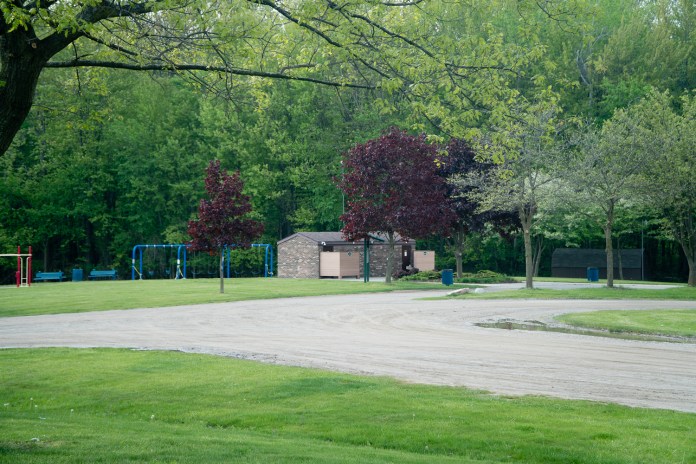
It goes through some industrial area west of Haggerty Rd, than is passes through by some marshes and ponds. Then towards its western end, it does through residential neighborhoods, and also by Gunnar Mettala Park in Wixom.

So, as far as scenery is concerned, I would not say, that it’s as scenic as West Bloomfield Trail or Huron Valley Trail, but it is still surrounded by a lot of greenery.

The trail crosses quite few busy roads, but the crossings use some kind of warning beacons for additional safety.

Connected Trails
As mentioned earlier, there are three trails that are connected to Michigan Air Line Trail:
- West Bloomfield Trail to the east of it leading towards Clinton River Trail further east;
- Huron Valley Trail to the west leading towards other trail in Kensington Metropark and Island Lake Recreation Area, and also a trail leading to South There is a sidewalk connector, called on the map above the “Temporary Route to Huron Valley Trail”. It is about 2 miles long;
- West of the M-5 bridge – the M-5 Metro Trail leading south to I-275 Metro Trail.
The combination of some of these connected trail provides routes for some long bike rides.

Additional Info
I could not find any information about hours when the trail is open, but I assume that it is like with other metro trail, it is open during the daylight hours and closed from dusk till dawn.
As when riding on other metropolitan trails, when crossing busy roads, you have to be extra careful. Even thought the Michigan Air Line Trail uses the additional safety equipment at crossing, you still have to make sure that the cars stop before proceeding through.

Final Thoughts
The Michigan Air Line Trail has been a great addition to other rail-trails in Metro Detroit area, connecting few trails that were disconnected before, and there was no easy way to travel by bicycle from one to another. It opens a world of opportunities for a long bike ride on the west side of the metropolis.

My Ratings
Scenery (0-boring, 10-breathtaking): 5.0 (going mostly through industrial area with some greenery in between, few scenic lakes, and wooded residential areas)
Easy-to-Follow (0-no maps, often broken into section without clear directions, 10-well marked with maps showing current location): 9.0 (no printed maps, but posted maps available in few places; trail well marked and easy to follow)
Food Access (0-no food facilities at all, 10-food available every few miles): 8.0 (many choices along, but not immediately of the trail)
Restrooms (0-none, 10-moderen restrooms every few miles): 5.0 (one restroom at the Gunnar Mettala Park, which should be enough for such a short trail)
Surface Quality: 10.0 (newly paved smooth surface)
Accessibility: 8.0 (for such a short trail enough parking areas to allow for fairly easy access; the only minus here is the lack of the immediate parking lots at both ends, but parking available nearby.)
Usage (0-not used at all, 10-extremely popular): 9.0 (very high usage)
Hills (0-completely flat, 10-Extremely hilly): 1.0 (the only “hill”, as mentioned before is the bridge over M-5)
Sun/Shade (0-no shade at all, 10-competely shaded): 0.0 (no shade at all)

Resources
Michigan Air Line Trail website
Michigan Trails Magazine – Michigan Air Line Trail

If you are interested in other bicycle trails in the southeast Michigan, here are my posts about:

