

The Great Allegheny Passage (GAP) and C&O Canal Towpath with over 330 miles is an excellent long-distance trail for a multi-day bike tour. Especially, for those, who don’t feel comfortable touring on roads.
Great Allegheny Passage Trail and C&O Canal Towpath – General Info
The Great Allegheny Passage (GAP) trail runs 150 miles through the heart of Pennsylvania. It (officially) begins in Cumberland MD and continues along Casselman River in the east, the Youghiogheny River in the middle, and briefly the Monongahela River in the west and ends in Point Park in downtown Pittsburgh.
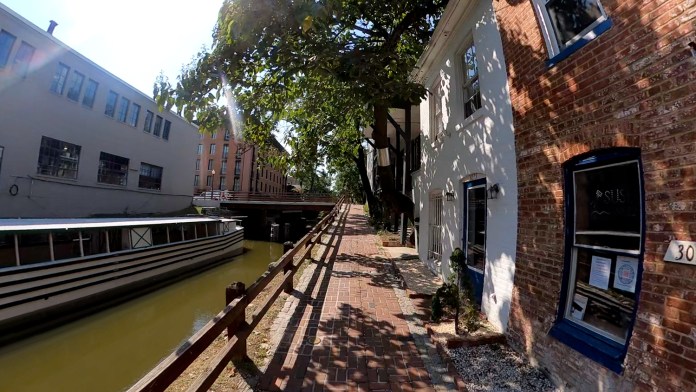
The C&O Canal Trail is 185 miles long and connects to the GAP Trail in Cumberland, MD. The trail officially starts in Georgetown, DC, and runs to Cumberland, MD along the Potomac River. It follows the state line just across the river from Virginia and West Virginia.

According to the Great Allegheny Passage official website, “…On the GAP, you’re never more than nine miles from a trail town, putting overnight lodging, dining, and outfitters within an easy ride or hike.
On the C&O Canal Towpath, which is within a National Historic Park, you’re in the woods for stretches of nearly 30 miles at a time, with abundant opportunities for camping. While some hamlets provide services, canal towns are spaced apart, so scheduling your stops takes some advanced planning.”
I rode both trails in the reverse order, starting in Pittsburgh and going to Washington, DC, first. Then I rode it, according to mile markers, starting at Mile 0 on the C&O, continuing to Cumberland, and then on the GAP Trail back to Pittsburgh.
In my post, I am writing about my progress from west to east. The reason behind it is that I think most riders ride the trails this way.

Vertical Profile & Elevation
Cyclists ride in both directions, but I think, that west to east is preferred, and there is a reason for it.
While both trails are pretty flat, the GAP crosses the eastern continental divide, so on both sides of it, it has to climb up to it. While the ascent on the western side of the divide is very gradual and impossible to notice, on the eastern side, from Cumberland to the divide (about 23 miles), it is steeper, and you will notice that you are climbing, especially, if you are riding a bike loaded with gear. The grade, still, is only about 2%.
There are also very short climbs out of canal sections (on the C&O) when the trail is routed through them.
Of course, the above description does not apply to detours. But more about them later.
Bike C&O – Elevation Charts (for both trails)

Pittsburgh – Parking and Trail Access
Pittsburgh, like any large city, has its good and bad neighborhoods.
When I went for a bike ride on GAP Trail around town, I was told by a local rider to avoid McKeesport, and that was because I mentioned that I parked there. I could see, that the town is rundown, unkempt, with some trash laying around here and there, and abandoned factory buildings.
Unfortunately, I stayed at the hotel in West Mifflin, by the county airport, and had to get to the GAP trail riding through West Mifflin and McKeesport. While I did not run into any trouble, I did not feel very comfortable in either town.

While researching the place to park my vehicle around Pittsburgh for the duration of the ride, I found out, that residents and cyclists do not recommend parking the car in any unsecured parking lots in town. There are some paid lots, but I could not find out how safe they are. The only detailed recommendation that I got was to park at the hotel in West Mifflin. And that is what I did. However, the ride to the trail from the hotel wasn’t what I would recommend. It was through abandoned parts of the city and on busy roads with a narrow shoulder.
Also, worth mentioning is that riding directly on the narrow streets and roads around Pittsburgh is not that safe. I’ve noticed, that drivers regularly drive at speeds exceeding speed limit by up to 20 miles per hour, and often give little regard to the cyclist on the road, passing him/her sometimes just inches away. Talking with some touring cyclists on the trail, I found out, that many of them choose the train to get either to Pittsburgh or Washington, DC. That solves the vehicle parking problem.
More info can be found on the website Great Allegheny Passage – Getting to the GAP.

One of the local cyclists that I talked to in Pittsburgh recommended leaving the car in the Boston Trailhead parking lot, claiming that it would be safe there for the duration of the ride. I did not have a chance to confirm it with anybody, so cannot vouch for the validity of this recommendation. Unfortunately, the official GAP Trail website Great Allegheny Passage Downtown Pittsburgh provides only very general info, without any mention of the security of your vehicle, or safety regarding riding through Pittsburgh suburbs.
I also have no idea how the parking and trail access aspect looks in Cumberland, MD, or Georgetown, DC.

Trail Surface Conditions
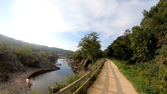
The Gap Trail has a packed crushed limestone surface and is fairly smooth. There are a few sections, here and there, that are a little rougher, but overall, it is a very smooth trail. When it is covered with crushed limestone, it is the kind with an average diameter of a quarter inch (few millimeters) or less.

The C&O Canal Towpath is often described as a dirt trail, which is only partially true. Big parts of the trail are limestone gravel and micro-gravel covered. The section of the trail from Shepherdstown to about 20 miles northwest of Washington is covered with micro-gravel with a diameter probably under ¼ inch (a few millimeters), which is hard pressed. The surface is very smooth and riding on it, at times, feels like riding on a paved trail. In fact, it is smoother than the GAP Trail. However, the whole trail varies a lot, from wide 8 to 10-foot gravel trail, to dirt roads, two-track, and even single track, from time to time. A few sections going through towns follow dirt/gravel roads. These roads are usually rougher than the trail.

Some riders on GAP Trail told me that the worst part of C&O Trail is the first 20 miles from Cumberland. This is not true. There are other sections of the trail that are equally bad.
Some sections have no gravel, just dirt. These are uneven, with roots and large rocks occasionally sticking out of the surface. These will also have more muddy patches after rain.
Then there are sections with rough gravel, with individual rocks the size of 1 inch or so. Because of the size of the gravel, riding on those is rough.
In general, expect to see a lot more mud on C&O Towpath than on GAP, after rains.

Tunnels
Out of four tunnels on GAP Trail, the Pinkerton does not have any lighting in it. The other three: Big Savage, Borden, and Brush have lights. It is still a good idea to bring a bike light for riding through tunnels. Even in those that have lighting, the light is so dim, that, at times, you can lose balance.

On C&O Towpath, the Paw Paw Tunnel is officially closed for renovation. When I rode the C&O in mid-September 2021, the tunnel was closed. There was a construction crew there. The path was barricaded. Riders were required to take the detour. However, I saw some comments online, that in July 2021, some people were able to ride through, even though there were signs for the detour…

Detours
In September 2021, there were no detours on GAP Trail. However, there were two major detours on the C&O Towpath.
The most often mentioned is the Paw Paw Tunnel detour. Maybe because the tunnels have been closed for a few years already. I consider this detour path ridiculous! The western part of it is a steeply ascending single track with roots and rocks all over. You could ride it up on an unloaded mountain bike, and that would be a workout. Pushing a loaded bike over a steep, winding path with rock and roots sticking out of the surface will take a lot out of you, and make you sweat like crazy. There is no way to ride this part of the detour on a loaded bike.
The other side (eastern) over the ridge is a dirt service road. Some parts of it can be ridden. However, there is a lot of loose gravel and loose dirt, and some sections are quite steep.
Going east to west, you most likely will have to walk your bike along both sections.
The detour is about a mile long, and as I said before, I consider it a ridiculous solution to the tunnel closure. It would be fine as a temporary way for a few weeks, maybe months. However, the tunnel has been closed for a few years now, and the NPS should have provided a better solution, knowing that primary users of the trail are bike tourers coming with loaded bicycles.
Again, at the time of my ride, September 2021, there was another detour on the C&O Towpath. This one was about 10 miles south of Williamsport. Most of it (99%) was on paved roads. It was about 4 miles long. The roads are hilly. A lot of ups and downs. But they are local roads with very little traffic.
Water Access – Along Both Trails
On the GAP Trail, there are no water pumps or fountains. You can get water only in trailhead parking lots and some campgrounds, and towns along the trail. So, sometimes, there might be a distance of several miles between water sources.
On the C&O Towpath, theoretically, it appears like water sources are very close together – only a few miles apart. However, what I found out during my ride in September 2021, was quite different.
There is a water pump at every Hiker-Biker campsite along the trail. The water comes from a well at each location and it is treated with iodine. Well, first, at some of those places, the water tasted horrible. It tasted like iodine. In other locations, there was only a hint of iodine, and the water was drinkable. So, it’s probably a good idea to bring a backpacking water filter with you to get rid of the iodine taste. Second, for some reason, the NPS removed handles from many pumps in the Hiker-Biker campsites along the trail. On average, I would say, every other pump had a handle removed. So, if it is like this in the future, don’t expect to be able to get water in every campsite location.

Additionally, two of the NPS-run campgrounds did not have working pumps at them. The Paw Paw Tunnel campground and Fifteen Mile Creek campground, both had handles removed. I find that ridiculous, especially, that the NPS charges $20/night for camping at these campgrounds.
I had only two water bottles and therefore needed often to refill them during several hot days. Therefore, I would suggest, that you bring more than just two bottles. I have seen people who had two bike bottles, and then two additional Nalgene 32 oz bottles. That would probably provide enough water for the whole day.
So, don’t trust the websites that say that there is water available along the trail at few-mile intervals and every biker/hiker campground.

Town Access Along Great Allegheny Passage Trail
There are many towns along the GAP Trail and the trail passes right through them, so access to town facilities is easy. When you look at the trail map, there are plenty of them. However, some of the smaller ones do not offer much.

Town Access Along C&O Canal Towpath
There are not as many towns along the C&O Canal Towpath, and they are always a little away from the trail. The access to some of them is not simple. Like for example in Harpers Ferry you need to carry your bags and bike up a few flights of stairs to the bridge leading to the town.
The terrain away from the river and canal becomes quickly hilly, and if the town or some of its facilities are a few miles away, the ride might be demanding. So, it’s worth researching ahead.

Food Services – Along Both Trails
There are diners, gas stations with food service, and restaurants in most towns along both trails. In bigger towns, there are multiple options. Again, on the GAP it is probably easier, and more often to find places, than on the C&O.
On the GAP, I never camped in a place where food wasn’t available locally. On the other hand, on the C&O Towpath, I camped in a few places where I ate what I brought with me, as there was nothing available nearby. It is especially true if you camp in Hiker-Biker campsites. They are usually away from towns (at least a few miles).
However, it is a lot more difficult to find a grocery store along both trails, when you want to buy food and prepare your own meals. In many cases, the stores are further away from the trails.

Environmental Conditions and Weather
Obviously, check the weather. Depending on when you decide to ride the trails, you might have to deal with heat, high humidity, rain, storms, and cold. I rode the trails in mid-September and had a week of very hot (90+ F) weather with 90% humidity. So, there were some nights that I slept only in shorts, and never covered myself at all.
After some storms, you might encounter a trail blocked by fallen trees and flooded tunnels. This might happen more often on the C&O Canal Towpath. The NPS service is good at addressing such issues fast, but if you ride the day after a storm, you might have to deal with such problems.
Another big issue is the mosquitos. Since the trails follow rivers and canals with a lot of standing water, there are mosquitos all over. They are especially bad along the C&O Canal. Therefore, bring the DEET or other insect repellent with you. You will need it!
When you are riding, it’s not a problem. Even when stopping during the day, it’s not a big problem. However, if you are camping, in the evening, then there are places where they are really bad. However, if you are staying in towns, in B&Bs, and/or hotels, it should not be an issue.

C&O Canal Towpath – Mile 0 Marker Location
I don’t know if it is important to you to get to the Mile 0 marker of the C&O Canal Towpath, but here is some info about it. It is not on the trail. The trail ends in Georgetown at Rock Creek and Potomac Pkwy NW. But, if you do want to get to the Mile 0 marker, you have to ride on Rock Creek Trail south under a few bridges till you get to the Rock Creek Park Trails parking. When you enter the parking, you should see the Thompson Boat Center. You need to ride behind the buildings, along the waterfront and once you get behind the last building you will notice the Mile 0 marker on the other side of a small channel.
Seeing some videos, where the authors suggested that it’s not easy to find, I printed myself a map. However, having a general idea of where it is, you can find it once you reach the end of the C&O Towpath (at Mile 1 marker).
Google Maps will show you where it is.

What Kind of Bike
I see people often asking what kind of bike you need to ride both trails. After riding them, I can say that a road bike with thin tires would not be enough. But on the other hand, a mountain bike with knobby tires would be an overkill. It would slow you down with its aggressive tread, wide tires, and lower tire pressure. So, the best bike to ride the GAP Trail and C&O Towpath would be a gravel bike, touring bike, or hybrid bike. I had 37 mm tires with a light touring tread, and I would say that it was a perfect choice. Not too slippery in mud, or hard on rough parts of the trail, but also sleek enough to give me good speed on a smooth surface.
However, I would also say that the C&O Towpath is a “gear destroyer”, and anything that is loose, or not very sturdy might fall apart, or break from the quite violent vibrations that you experience on some trail sections… I had a very sturdy GoPro gooseneck mount on my bicycle, which simply broke from a fatigue fracture on the C&O Towpath. Luckily, the tough GoPro survived.

Wildlife You Might Encounter
Both states Pennsylvania and Maryland have a healthy population of black bears. If you research the subject, you find that they live in most of the counties that both trails are passing through. However, for some reason, in general, you should not worry about bear encounters. I don’t know what the reason is, but they are not present along the trail and rivers in Pennsylvania, and along the Potomac River and canal in Maryland.
One guy told me, that a few years ago, there was a bear sighting in Meyersdale in the Spring.
You still encounter plenty of other wildlife. During my trip, I encountered deer, rabbits, quite large black snakes on the C&O, squirrels, chipmunks, herons, and black vultures in Maryland, closer to Washington.
Camping Along Both Trails (trains, road noise, mosquitos)
Many campgrounds along both trails have the same issue – they are close to the railroad tracks. And if you are a light sleeper, you might not be able to sleep much, with constant train traffic.
If you sleep like a log, skip this section. However, if you are easily awakened, you might want to read this.
I spent nights in some campgrounds where I did not get much sleep because of trains constantly rolling by.

One, is the nice primitive campground in Rockwood, right by the trail – Husky Haven Campground. While the campground is very popular with bike tourers, the railroad is on the other side of the river.
A cyclist that I met at the campground told me: “When you are in your tent at night and the train goes by, it will feel like it is passing right through your tent.”. I thought it was a little exaggeration. No, he was right!
Another one is in Brunswick on the C&O – Brunswick Family Campground. There is a train changing station almost next to the campground. Constant running train noise through the entire night.
As I have mentioned before, mosquitos are ever-present, and you will find them also in every campground. The Brunswick Family Campground and Fifteen Mile Creek Campground were especially infested.

Trail Alerts
Check the trail alerts before you go. They will prepare you for any surprises you might encounter. Some alerts are available on the following sites:

Cell Signal & Wi-Fi
The cell signal is mostly available. But occasionally, there are short sections where there is no signal.
Wi-Fi is available in some restaurants in bigger towns. I did not get it in any of the campgrounds that I stayed at, even those some of them advertise it.

The Places I Recommend
Since I did only a quick tour from Pittsburgh to Georgetown and back in less than two weeks, exclusively camping at night, and not staying in B&Bs or hotels, I don’t have a complete picture of what is available, and what is good or bad along the trails and in trail towns. However, there are a few places that I liked, and I would recommend them.

- Connellsville – Adirondack Shelter campground – There are only four shelters. They are on the north side of town (Pittsburgh side). Camping there is free. There is a running water fountain with “city” water. They are right next to the big grocery store where you can get all kinds of food. Additionally, the town with many facilities, restaurants, diners and more stores is really close. The restroom in the campground is a vault type and not very clean. If you need to charge electronic devices, there are a few outlets on the outside of the blue building by the trail, in the direction of the restroom. The railroad is not far away, so you will hear trains at times at night.
- Ohiopyle – Falls Market has a great ice cream. Additionally, there is a restaurant with some fairly good food.
- Meyersdale – Festival Park Campground – a very nice and quiet campground in the center of town. Popular with bike travelers. Showers, running toilets, electrical outlets. You need to register at the Donges Diner. Food is available in a few places around including Sheets at the gas station, where you can also get beer.
- Williamsport – Hagerstown/Antietam Battlefield KOA Kampground – 4 hilly miles away from the trail. But if you are looking for a nice shower, laundry, campground store, delivered pizza, pool, electricity to charge your devices, and very nice and helpful staff – this is the place. It is not cheap at over $43/night (2021 rate) for a tent site, but the amenities are worth it.
- Brunswick – Beans in the Belfry – café in a former church. A unique place with great coffee, some tasty pastries, and quite good breakfast food. Definitely worth visiting, if not for the great food, then for a unique ambiance.
- Georgetown – Ristorante Piccolo – I stopped for a meal at this Italian restaurant and was impressed by the delicious food I had and the quality of service. I definitely recommend it.

Resources

* * *
If you are interested in bike touring, you might want to check my other posts related to the subject: