

This is a part 3 of my post about Lake Michigan Tour by bicycle. This section talks about the riding from Manitowoc, WI, through northern Wisconsin, Upper Peninsula of Michigan, to Mackinaw City, MI.
If you have not read previous parts of my post, first part is available here.

Lake Michigan Tour by Bicycle – From Manitowoc, WI to Mackinaw City, MI
Manitowoc to Green Bay (43 miles/69 kilometers)
Green Bay, my destination today, was located not too far away. It should be an easy ride.
From Manitowoc I took 8th St to cross over the river. Once I was on the north side of it, I turned left (west) on Maritime Dr, and soon after, turned north on N 10th St.
(Be careful here as Google map calls both - 8th St and 10th St - Vietnam War Veteran Memorial Hwy. I don't remember, but I don't think it's correct!)
I followed it for about a half mile and then turned left (going northwest) on N Water St, only to turn soon on N 11th St/Vietnam War Veteran Memorial Hwy going north. Then, I turned left on Menasha Ave (again going northwest). Then I turned north on N 18th St. Soon the street changes the name to County Road Q (Google Maps also show it as Cty Tk Q). I kept following it for a while, till I got to Shoto Rd, which I followed west to Devil River State Trail.
The Devil River State Trail is a gravel trail, and as soon as I got on it, I realized that the gravel was very loose, and therefore hard to ride. So, I decided to follow the roads instead. The county roads had a nice surface, and the traffic was quite low.
So, I continued on Shoto Rd west to County Rd R/N Packer Dr, which I turned onto and followed north. Unfortunately, there was a road construction around Francis Creek. The road was completely closed. So, I did not have a choice, but to go back on the trail. I rode on the trail for a few miles, and once I saw that there was no more construction, I switched back to the road.
I got off the County Rod R in Denmark, only to stop at the gas station. From the gas station, I took local streets to get back on County Rd R. When you cross the Pine Grove Rd, County Rd R changes to Main St, since it is already on the outskirts of Green Bay. Eventually, Main St is joined by 141 and 29, and it becomes more and more busy. I followed it all the way to downtown. There is no other choice. (The Davil River State Trail ended in Denmark.) I guess, you could take one of the other major streets, but I would think they would be as busy.
I stayed overnight in the eastern park of the city. Many areas looked quite poor and run down and I wonder how safe they would be at night.
I had a hard time finding a grocery store in this area of the city. There were few convenience stores, but no grocery store. I ended up buying some food at a small Mexican market.
The ride was almost entirely on streets and roads. Most of the time they had low amount of traffic. Only when I got close to Green Bay the traffic increased significantly. Most drivers were great and kept a good distance once passing, but there were occasional impatient/inconsiderate ones that passed me at the small, unsafe distance. Unfortunately, the Main St stretch to Green Bay doesn’t have much shoulder – only about 2 ft (60 cm), and half of it is a ramble strip.

Green Bay to Marinette (58 miles/93 kilometers)
I wanted to stay in Green Bay with one of the Warmshowers hosts. But the two I contacted were either busy or already had someone coming, so I stayed at a hotel.
In the morning I crossed Fox River by taking E Walnut St. On the north side I briefly followed the street and turned right (northeast) on N Broadway St. Then I turned left (northwest) on Dousman St. I rode on it for over a mile, and turned right (northeast) on N Oneida St, then left on Division St and right again on Wilson Ave. After four blocks, I turned left on Mather St, and then after riding 6 blocks, I turned right (northeast) on N Platten St. till 141/Velp Ave. I crossed the road, and rode through the parking lot to Donald St, running parallel to 141. I followed it till it ended at N Military Ave, on which I turned right (northeast). Before the 43 freeway, I turned left (northwest) on Wietor Dr. I followed Wietor Dr all the way till its end. It ends with a circular turnaround. From thee I took a trail leading towards the highway. It follows the west side of the highway for short while, and then does a big loop and crosses under the freeway to the eastern side of it. Then it turns into a street – E Deerfield Ave. I followed the street till it intersects with N Lakeview Dr, which I took east. Soon it turns into County Rd Eb. Later – County Rd J. Few miles later it joins the Riverside Dr and then goes separately north again as Lakeview Dr/County Rd J, which I kept following. Finally, when it crosses County Hwy S, I began following County Hwy S going northeast. I followed it for a while. It took me through Pensaukee, and all the way to Oconto. In Oconto, County Hwy S/County Rd S changes the name to Collins Ave. I followed it to Main St, which I took east (right). It soon changes into County Rd Y, which I followed north. The road follows the Lake Michigan shoreline. To get to the park, I took Bay Rd.
I took a break in North Bayshore County Park, a nice little park on Lake Michigan.
From the park I followed Bay Rd, only to soon turn left (north) on Hale Rd (Be careful, as it turns east at one point, and if you go straight you will end up on Felmer Rd, which dead ends soon.) Soon, right before the US Hwy 41, I took an unnamed drive/trail on the right, which allowed me to cross Peshtigo River, and followed the freeway to Pierce Ave. I turned right on Pierce Ave (southeast) and followed it for about 5 miles, till University Dr on the outskirts of Marinette. Then I took University Dr all the way to W Bay Shore St, which I followed north.
I made another rest stop in Runnoe Park.
From the park I kept following W Bay Shore St, but soon, I turned west (left) on Edwin St, then right (north) on Shore Dr, west (left) on Cleveland Ave, north (right) on Pierce Ave, west (left) on Carney Ave, which got me to the hotel where I was staying.
The ride was easy, even though it was all day on roads. However, the roads often had a wide shoulder, and the traffic was light.
If you look at the map, you will ask why I did not ride more direct route to Marinette. I could have ridden to Peshtigo on Hale Rd, and then take Maple St and Old Peshtigo Rd and a few residential streets to town. However, I also wanted to do some sightseeing and wanted to get some views of the lake.
The weather was fair, and I did not mind few extra miles.
This was my last stop in Wisconsin. Tomorrow in the morning I will be back in Michigan.
Marinette to Escanaba (64 miles/102 Kilometers)
To get to Escanaba I basically had two options, two main roads that go north.
- One option, would be to go inland on US-41, and in Spalding go east on US-2.
- The other option, was to take M-35 roughly following Lake Michigan shoreline.
Since I thought that the temperature will be lower closer to the lake, and also that like the views of the lake, I chose M-35.
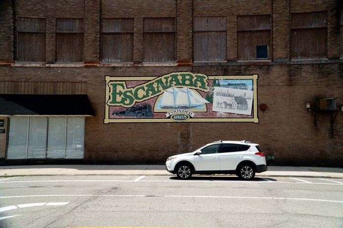
(By the way, if you want to learn more about Escanaba, here is my post about it: Should Escanaba Be On Your List of Places to Visit in U.P.? )
To get to it from Marinette, I took Carney Blvd east, in town, towards the lake, till I got to W Hosmer St. I turned northeast (left) on W Hosmer St and took it for a short stretch to Ogden St, which I followed north. I crossed over the Menominee River. On the other side the Ogden St becomes 1st St, which I kept following to 14th Ave. I went west (left) on 14th Ave, for one block, and turned north (right) on 7th St, which took me to 10th St/M-35/US-41. I took it north. Soon they split and 10th St/US-41 goes north, and M-35 goes northeast, following the shoreline.
I followed the road, pretty much, all the way to Escanaba. The first 20 miles had a wide shoulder, about 7 feet (2 m). For the next 20 the shoulder was very narrow, only to widen again for the last 10 miles. It is important because the road is busy as hell. During my ride (about 5 hours) I was passed literally by thousands of vehicles (going both ways). While a majority of drivers were courteous and gave me a lot of room while passing, there were few that passed me within a foot (30 cm) distance, going at high speed. And that is like playing Russian roulette. Unfortunately, there is no other direct way to get from Marinette to Escanaba. The US-41 is equally busy.
Therefore, if you are not comfortable riding that stretch of your route, you can travel it by bus. The Indian Trails buses travel regularly between the cities. The current ticket price for one person is only $14. However, there are other possible costs, when considering some additional luggage. The bike has to be packed. However, I’ve heard, that many at many bus terminals you can buy a cardboard box for your bike. Read more about it here: Indian Trails .
When I got to the vicinity of Escanaba, I got off the M-35 on Lake Shore Dr. Of course, you could follow M-35 all the way to downtown. However, I wanted to see the waterfront in the city, and stop at the lighthouse.

Today’s ride was stressful because of high traffic and close proximity of passing cars. But this is Michigan. The state promotes biking, but they do not protect cyclists. Most roads in Michigan designated for cycling will have signs “Share the road”, which in reality is a joke!
The day wasn’t hot though, with the temperature hovering around 80 degrees F (27 deg. C).
Of course, since I was in the U.P. I had to stop and have a pasty. (If you don’t know what a pasty is, read my post about it here: What the Heck are Pasties? ) The place where I stop when I am in Escanaba to get them is Gram’s Pasties – a small place on Ludington St, between 25th and 26th St.

Escanaba to Gulliver (71 miles/114 kilometers)
Another high traffic route that I had to follow was the US-2 through Upper Peninsula of Michigan.
Since there weren’t any particular places that I considered visiting in the U.P, I wanted to get to the Lower Peninsula as soon as possible, and decided to do it in two days, splitting the distance, roughly, in half.
So, my next stop would be in Gulliver. That meant a relatively long day ride of about 70 miles (112 km).
To get out of Escanaba I took N Lincoln Rd/M 35/US 41/US 2 north, through Gladstone and to Rapid River, where US 2 diverges from US 41, and goes east. I followed the highway through Isabella, Thompson and Manistique to Gulliver.

Gulliver is pretty much just a marker on the map. There is nothing there. Therefore, if you need food or drink, you need to buy it earlier. The last gas station with convenience store going east is about 5 – 6 miles before Gulliver. If you don’t mind riding a little bit more, there is one just one mile further east.
Riding on US 2 wasn’t as bad as I was expecting. Most of the time the road has a wide shoulder – between 7 – 8 feet (2 – 2.5 m). It is definitely needed. The traffic on the road is insane – constant flow of vehicles in both directions. There are however, some small sections where there is almost no shoulder – like bridge crossings, or road sections through some towns. I had to stop few times, at those, to let the flow of cars pass before I rushed through before the next traffic wave, if I was lucky!
Mind you, US 2 is the official cycling route through the Upper Peninsula! However, again, there are some unsafe short sections… The road occasionally provides for some spectacular views of the lake.
I stayed in a basic motel in Gulliver because there was supposed to be a storm at night, which didn’t materialize. I could’ve stayed in one of the many campgrounds along the way.
The motel was the Dreamland Motel. I cannot give it high marks. First, it was operated remotely. All my exchanges with whoever was running it were through text messages. Next, it was very basic – no coffee maker, no fridge, no microwave. Even though there was wifi, there was no internet. I texted a message to the management about it, but did not get any response. The motel was clean though. However, for over $100 a night, it was expensive, for what and where it was.
The place was really taking advantage of the fact that there was nothing else around.
Next day in the morning before leaving I talked to three Harley “bikers” that also spent a night in the motel. They were trying to get some coffee. There was a restaurant at the motel that supposedly was open in the morning. However, they were told that 3 basic cups of coffee will run them $15, which was ridiculously expensive, for basic coffee, so they decided to wait till they get to the gas station, where they can have a coffee for $1 or $2.
The ride was not as stressful as yesterday. I also did not have any headwind like on many previous days, and the temperature was in the 70s (low 20s deg C).

Gulliver to Mackinaw City (74 miles/118 kilometers)
Another long day of riding through the Upper Peninsula.
Since I had a long day ahead of me I left pretty early, around 8:30. I would have left earlies, but I was talking for a while with those Harley guys.
Today, as yesterday, most of the riding was along the US 2. The traffic pretty quickly picked up to almost constant flow of cars. Riding was good with finally some tailwind from time to time. As I was getting closer to the bridge, the traffic got even busier – with constant flow with no breaks.
However, as before, most of the highway had a 7 – 8 foot (2 – 2.5 m) shoulder, but there were again few places with very little.
I again stopped at a pasty shop to get some food. This time it was at Lehto’s Pasties, about 5 – 6 miles (8 – 10 km) west from the bridge.
The closer I got to the Mackinac Bridge, the more impatient the drivers got, and the faster they drove.
Since I got to the bridge relatively early, I decided to cross over to Lower Peninsula.
Mackinac Bridge Crossing Options
There are two ways you can do it:
- Get a transfer ride over the bridge (bikes are not allowed on the bridge). You have to request it from the Mackinac Bridge Authority. The current price (2022) is $15. To find out more check out the Mackinac Bridge Authority website.
- The other way to get to the Lower Peninsula is to take ferry from St. Ignace to Mackinac Island and then a ferry from Mackinac Island to Mackinaw City. To get more information about ferry services (there are two companies) check out the Mackinac Island Ferries website. This option is more expensive an probably takes more time. However, you can spend some time on Mackinac Island, or even if you have time and strength, ride around the island (about 6 miles). The ferry trip from St. Ignace (you and bike) to Mackinaw City will cost you around $50 (2022 prices).

I chose the ferry option. So, I followed US 2 to St. Ignace. The road changes to N State St in town. And I went to the dock. I got on a 3:30 ferry to Mackinac Island, and once there I immediately got on ferry to Mackinaw City.
I camped that night in the Mackinaw Mill Creek Campground, just about two miles south of town along US 23. The primitive campsite cost me $25. The mosquitos were bad, so I went to bed early. It rained at night.
To be continued…
