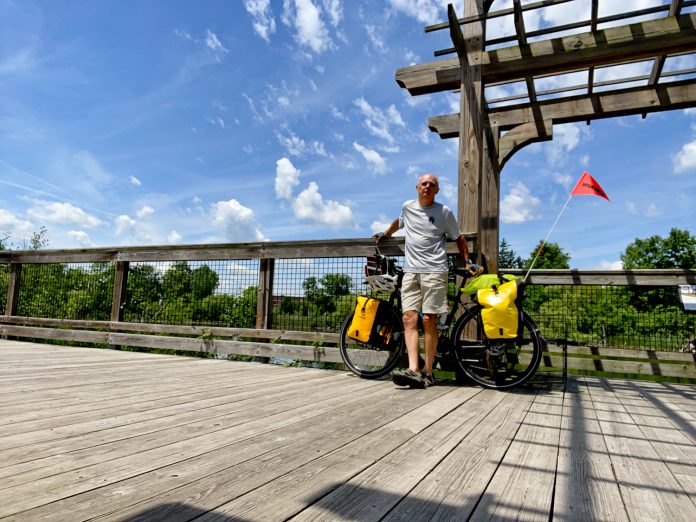
Expanding my bike touring experience, I decided to go on a longer – one month – tour, to ride around Lake Michigan.
I began my ride straight from home, in the northeast suburbs of Detroit. Therefore, to get to the Lake Michigan shoreline I decided to follow the Great Lake-to-Lake Trail Route 1.
Some 20 days later, after I finished my ride around Lake Michigan, I followed, pretty much, the same route back home.
Since the whole story was quite long, I broke it into two parts. This is part 1 of the Great Lake-to-Lake Trail Route 1 post.
(The circle tour around Lake Michigan is a part of five posts starting with the Lake Michigan Circle Tour – The Great Bike Touring Adventure (part 1).)

Lake-to-Lake Trail Route 1 – from Detroit Suburbs to South Haven and Back
Route
Not everybody is familiar with the recently created Great Lake-to-Lake Trail Route 1, so let me briefly talk about it. The route is the first one of five proposed routes connecting two different of the Great Lakes, and cutting through Lower and Upper Peninsulas – three in the Lower and two in the Upper.
Route 1, which is the only one officially open right now, connects South Haven with Port Huron.
One important thing, that I want to point out here, is that Route 1 is NOT A TRAIL! The route consists of many local trails connected by some local not-so-busy, or sometimes quite busy streets and roads. Therefore, the word ‘trail’ should be removed from the official name, because it’s misleading. It should be called the Great Lake-to-Lake Route 1. At least, till the time when all the gaps between the trails are closed.
The whole stretch from South Haven to Port Huron amounts to 275 miles (440 km).
More details about the route are given later on in the daily segments. I am actually providing a very detailed description of my route hoping that it will help other people with planning their trip. I, myself, while planning my ride, was looking for information like that. However, if you just want to read about my daily experiences, but are not interested in detailed trip routing skip the segments in italics.

Time
It took four days for me to get from the Detroit area to South Haven. I began my ride in the middle of June. And I rode back home – in July – after my tour around Lake Michigan.
My Ride
I want to put a disclaimer right here! So, I did not ride the whole Great Lake-to-Lake Trail Route 1. I began my journey in the suburbs of Detroit. It means that I did not ride the section from Port Huron to Richmond (from Richmond you follow the Macomb Orchard Trail, which was, albeit not in the entirety, part of my route). And I will talk about it more later on.
As I have mentioned above, it took me four days to get to South Haven, where my ride around Lake Michigan began. In these four days, I rode the following sections:
- Detroit suburbs to Pickney/Hell area.
- Pickney/Hell to Albion.
- Albion to Kalamazoo.
- Kalamazoo to South Haven.
Each section consisted of mostly trail riding, but included some road riding as well.

Detroit to Hell (65 miles/104 km)
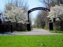
I began the ride on Macomb Orchard Trail which stretches for 24 miles from Rochester to Richmond. It is a paved trail and probably one of the nicest trails in southeastern Michigan.
After a few miles, the trail ends at the border of Macomb and Oakland counties, at Dequindre Rd. There it joins, on the western side of the road, the Clinton River Trail, on which I continued west.
Clinton River Trail is one of the worst trails that I have ridden on in Michigan. The reason for this is its surface. It used to be mostly gravel (there is a short old asphalt section close to Auburn Hills). However, at one point some genius decided to cover it with recycled asphalt! That made it rough and bumpy and hard to ride. Many people still use the trail because it’s close to where they live, but it is horrible, in my humble opinion. So, going on it was slow.
The trail has a “discontinuity” around the city of Pontiac. When you get to Opdyke Rd, you need to follow a trail/sidewalk south on the eastern side of the road. Do not follow the Google Maps recommended routing. It is not a good way to go!
By the way, for those of you who are not from the Detroit area, the city of Pontiac, just north of the path, is not the safest place to stop. So, if you need to resupply on anything, do it before or after – in the area of the city of Rochester, or later, when you get to West Bloomfield.
So, I followed Opdyke Rd to S Boulevard and took it west, or actually the sidewalk/trail on the north side of the road. I followed it west for about two miles, till it ended at Bagley St.
You have to cross busy Woodward Ave. Be careful there, as the crossing is not bike-friendly, and the road is quite wide, with eight lanes of traffic and a median.
When I got to Bagley St I turned north (right) on it and followed it north till I got to the Clinton River Trail on the left side (about a mile). Then I took the trail west.
Somewhere west of the second crossing of Orchard Lake Rd, the trail ends, and the West Bloomfield Trail begins. There is no big official trail sign there. There is only a little post on the side of the trail indicating the trails.
The West Bloomfield Trail is a gravel trail. It is quite nice and smooth. (You can read more about it in my post – West Bloomfield Trail…) It is a short trail, but since it connects to other trails at both ends, it is quite popular. At times, it offers some nice views of nature, even though, it goes through some quite congested urban areas.
I kept following the West Bloomfield Trail till it ended at Haggerty Rd. There, I crossed the road and kept going west on the next trail.
It is one of the newest trails in Michigan – the Michigan Air Line Trail. (You read more about it in my post – Michigan Air Line Trail…)
It is another short trail, at 6 miles. But since it is connected to other trails at both ends, it is also quite popular. It is a paved trail, and the busy road crossings have some modern warning aids for the road traffic.
The trail ends at N Wixom Rd. (Don’t follow the Google map routing, as it is incorrect!).
So, once I got to Wixom Rd, I followed it south to the intersection with Pontiac Trail. I crossed Pontiac Trail, and I followed it west along the sidewalk/trail on its south side. In about a quarter mile, when I just passed the Gibson House (a local historic landmark), on the north side of the road there is a connector trail that I took north to Michigan Air Line Trail extension connecting it to Huron Valley Trail.
Then I kept following Huron Valley Trail west.
It is an old paved trail. You have to pay attention to it because it splits into two legs (or spurs) immediately south of the I-96 tunnel. The left leg goes south to South Lion. The west (right) leg takes you to Island Lake Recreational Area. You need to follow the west leg. After it crosses Kent Lake Rd, it becomes the Island Lake Pathway, which I kept following west through the park. Shortly, I got to the parking lot. There is another split there. The north (right) leg goes to Kensington Metropark, and the south (left) leg goes south and then west.
I actually got off the trail at one point, before the split (at Kensington Rd), and followed State Pkwy west, since the trail meanders a lot. The road was not busy, and it is often used by cyclists. I took it all the way to the railroad south of Island Lake, and there I took the unnamed trail on the left. It takes you to the shopping mall, There, when I got to the traffic circle, I turned southwest (left) on Village Pl Blvd. When I got to 2nd Ave, I took it south (left) and followed it to Fieldcrest Dr. There is a trail along the road, and I followed it south. It ends at Silver Lake Rd. There I had to cross to the other side under the US-23 overpass. On the other side, I followed Whitmore Lake Rd south (left turn). I followed the road for about 4 – 5 miles (6.5 – 8 km).
This was the first “break” in the Lake-to-Lake “Trail” where you have to ride on sometimes busy roads. Whitmore Lake Rd has a shoulder and is not bad. But it is not a trail.
When I got to 9 Mile Rd, I crossed it, and right there on the west side of the road, just across from McDonald’s and past the gas station, the Mike Levine Lakelands Trails begins. (You can read more about Mike Levine Lakelands Trail in my post – What you need to know about Mike Levine Lakelands Trail…)
You have to look for it, as there is no sign there.
This is a long trail – 34 miles. The first 11 miles are paved. The rest is dirt and limestone. The trail is quite smooth, except for an occasional chipmunk hole.
I followed the trail past Pickney, till I got to Cedar Lake Rd.
Even though there are two different recreation areas, Pickney Recreation Area and Brighton Recreation Area, both with camping, I could not find a spot there to reserve. It is summer, and both areas, being close to big cities, are very busy.
Therefore, I reserved a spot in a private campground a few miles south of the trail – Hell Creek Campground. It was only about 2 miles south of the trail down Cedar Lake Rd, which by the way, is a dirt road. However, it was not easy to ride. The road was quite hilly, and I was already tired.
Most of the day I had some headwind. In the afternoon, it rained a few times – mostly light rain, except the last one, which was a downpour. But it lasted only about half an hour. Luckily, the downpour came when I stopped at the store, shorty before getting to the campground.
I set up my tent, took a shower, ate, and went to bed.
It was the first day of my month-long tour, and it went well. I was quite tired at the end of the day, but since it was the first day, I expected it. I have been biking almost daily since the Spring, but now the bike was loaded with 50 lbs. (23 kg) of gear.

Hell to Albion (62 miles/99 km)
I got up early around 7, but did not leave the campground till 9:30. There was a lot of condensation on the tent and I did not want to pack it wet, so I had to try to dry it as much as possible.
When I finally got on the road, I did not ride back to the trail along Cedar Lake Rd. I went through Hell instead.
Hell is a very small town southeast of Pickney. I rode that way only so I could say that “I went through Hell”…
So, from the campground, I went south (right) on Cedar Lake Rd, and soon turned west (right) on Patterson Lake Rd/D32. And soon I went through Hell.
I wouldn’t even know it was Hell, if not for a place like Hell Hole Bar with its prominent sign.
I kept following the road till it merged with Doyle Rd and then kept following Doyle Rd west (left). Then at the fork of Doyle and Unadilla, Doyle Rd goes west (left) and Unadilla Rd goes north (right), I followed Unadilla Rd and soon later Bullis Rd. It took me back to the Mike Levine Lakelands Trail, just north of M-36.
I took the trail west (left turn). I followed the trail through the towns of Gregory, Stockbridge, and Munith.
I followed it all the way to the end at the last trailhead – The Herb Amster Trailhead at Hawkins Rd.
At the time when I arrived at the west trailhead (June 2022), I could see that they had begun working on the stretch that is supposed to take the trail further southwest to Jackson.
From the trailhead parking lot, I got on Hawkins Rd and followed it south (right turn). The road didn’t have much shoulder, but the traffic was light. Soon, I turned west (right) on Seymour Rd. Shortly after, it turned into O’Leary Rd, which I kept riding on. I followed it till N Elm Ave, where I turned north (right turn). I followed N Elm Ave, and soon it turned into E Parnall Rd. I kept following E Parnall Rd to Lansing Ave, and tool Lansing Ave south (left turn). I followed Lansing Ave south of I-94 to Hillsdale St, which I took east (left). At the end of it, I turned south (right) on N Blackstone St. I followed it to W Monroe St, which I took east (left), and just past the creek I got on the Armory Arts Walk trail going south (right turn).
The trail is short. It ends on the Jackson Historic Prison grounds, shortly after the traffic circle.
By the way, the Jackson Historic Prison looks like an interesting place, and I found out later that you can tour it.
When the trail ended, I kept riding south on N Mechanic St. At Homewild Ave, I turned east (left) and followed it for two blocks to Martin Luther King Jr Dr, which I followed south (right). At the traffic circle, I followed E Morrell St east (left turn). Then, just before S Cooper ST/BUS-127, I took the unnamed trail south (right). That trail soon joined Inter City Bike Trail (new name: MLK Equality Trail – not changed on Google Maps yet) going southwest.
I was glad to be off the roads, because some of them were quite busy, and a little uncomfortable. It was another “discontinuity” in the so-called ‘trail’!
After I crossed Weatherwax Dr, the trail changed its name to Falling Waters Trail.
It is a 10.5 mile, paved trail connecting Jackson with Concord. It ends just after crossing the bridge over Mill Pond in Concord.
From there, I kept following River St west.
When you get to N Main St, it appears that there is no trail between Main St and Spring St. Maybe it is not the trail, but you can keep riding west on the dirt road there, and continue on the trail west of Spring St. This is what I did.
The trail ends at Allman Rd. There, I turned west (right) on Allman Rd. It eventually turned into J Dr. S. I followed it to 29 Mile Rd, which I took north (right). I followed it for a few miles, and it took me almost all the way to Albion.
Most of the roads between Concord and Albion don’t have a shoulder. However, the traffic on them is minimal. During my ride from Concord to Albion, I encountered only two cars.
I think it was when I was getting out of Concord, I got chased by a dog, which later was joined by another one. Luckily, I was able to get away… It was the only encounter with chasing dogs on my month-long tour…
When 29 Mile Rd ended at Albion Rd, I turned west (left) on Albion Rd. It soon changes its name to Haven Rd. I followed it to S Hannah St, which I took north (right). I followed it for a few hundred feet to Veterans Way (on the left). Then I followed Veterans Way to the Albion River Trail.
I followed the trail northwest (it soon had a split). I followed it towards the town.
I ended up riding on it to E Erie St.
I was staying tonight at Warmshowers host’s place in Albion. I got to town earlier and therefore decided to first get something to eat before going to my host’s house.
When I was riding on the Albion River Trail I began to hear some music. There were some festivities going on somewhere. I kept following the sound.
So, when I got to E Erie St, I turned west (left) as the sound was coming from that direction. Soon I turned south (left) on S Superior St.
When I got close, I could see that there was some kind of festival happening in town.
I stopped on W Ash St, just on the side of Albion Malleable Brewing Company.
As I soon found out, there was a bluegrass festival in progress.
Before I could get off my bike a guy came over. He said: “HI! I’m Charles… Are you hungry? Are you thirsty? We can get you food. We can get you something to drink…” While I was locking my bike he came back with a cup of cold beer. I didn’t know it at the time, but it was one of the co-owners of the pub…
A little later I ordered some food, while occasionally talking with Charles.
Later he asked me if I needed a place to stay. I told him that I was staying with Warmshowers host. Of course, he knew who I was talking about. Albion is a small town. Everybody knows everybody. And since there was only one Warmshowers host in town, he knew exactly who it was. He said: “She is here at the festival. We will find her for you.”
After eating, I went to my host’s house. She was already there waiting for me, and eager to return to the festival. I quickly took a shower and then went to her backyard right on the Kalamazoo River to set up my tent. Then I rode back downtown to enjoy the festival. I met more people there, drank more beer, and enjoyed the music. Came back to my tent around 10:30.
So far, the trip was unfolding quite nicely.
Sometimes looks can be deceiving. I did not know much about Albion before getting there. When I got there I got the impression that it was a friendly and nice small college town. However, I recently happened to read an article listing the most dangerous cities in Michigan and Albion is high on that list. (Read about it here in one of the articles about high-crime cities in Michigan.)
By the way, my next stop – Kalamazoo – is another one high on the high crime list.

To be continued…
Resources
- Michigan Trails – Great Lake to Lake Trail – Rte 1 (east)
- Michigan Trails – Great Lake to Lake Trail – Rte 1 (west)
- The Great Lake-to-Lake Trail RTE 1
- Great Lake to Lake Trails (Do NOT trust! Looks official, but can’t find out who owns the site!)
- Clinton River Trail
- Michigan Trails – Clinton River Trail
- Michigan Air Line Trail
- Michigan Trails – Michigan Air Line Trail
- Michigan Trails – Huron Valley Trail
- Jackson County Parks – Falling Waters Trail
- Michigan Trails – Falling Waters Trail
- Michigan trails – Albion River Trail
- Calhoun County Trailway Alliance
- Michigan Trails – Calhoun County Trailway
- Michigan Trails – Battle Creek Linear Park
- Michigan Trails – Kalamazoo River Valley Trail
- Michigan Trails – Kal-Haven Trail
- Michigan Trails – Van Buren Trail State Park


